An internet search provides:
- Wikipedia© Whixall, by land area, the third largest inland village in England and a civil parish in Shropshire
- Google © Whixall is a small and rural village and civil parish in Shropshire
The village reference may be pushing it a bit far as Whixall does not have a natural centre. Civil Parish probably sums it up better as residents are spread right across the locality from single farms to small collections of buildings/houses. Visitors commonly vent frustration at ‘getting lost’ while residents are happy to be reported missing in the ‘Whixall Triangle’.
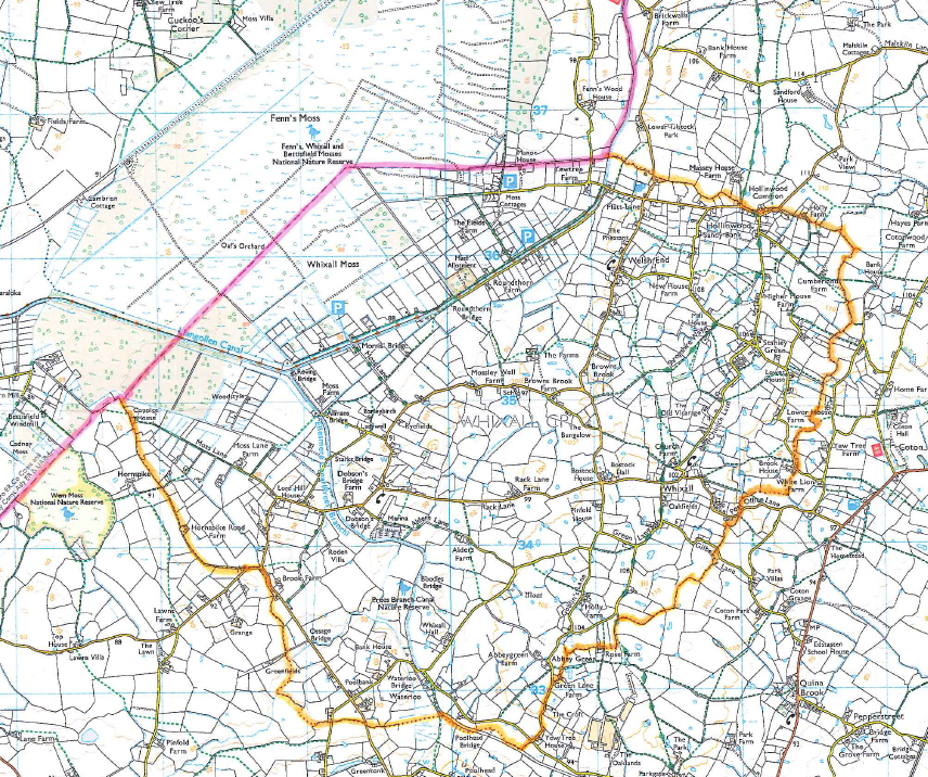
The map below (Ordnance Survey©) shows the extent of the Parish. The pink line, north border, is also the English /Welsh border with the orange line showing the extent of the rest of the Parish to all other points of the compass.
Fenn’s Moss (in Wales) is also shown as historical items from here will also be included in these pages – the history of Whixall being intertwined with the whole Moss.